1980 is the beginning of China’s economic reforming and opening up. Leroy W. Demery, Jr. , an 27 years old American, decided to cross the ocean and check out the mystery east. His first stop is HongKong. During the time in HK, the tour guide asked him if he’d like to spend an afternoon in a place next to HK but across the sea. And he said “YES”. The place he went to is Sheng Zhen, the first city to start reform and open up in China in 1979.
Leroy recorded the original ShenZheng in the last minute, before all these got replaced by factories. He came to China again in 1983, visited a lot of other cities and recorded all of them. I am kind of curious why this old country pick this young man from the west to record how this land looks like before everything totally changed, but I am really glad to get to see these treasure images today. Not only me, same as a lot of people. Leroy start to put these photos on flickr since Dec,2008 and attract tons of viewers. Among these viewers, there is a curator of ShenZhen & HongKong architecture biannual, and the result is these photos will be exhibited in the show.
Check them out now on Leroy W. Demery, Jr.’s flickr album.
http://flickr.com/photos/lwdemery/
http://www.flickr.com/photos/gedawei/collections/
Leroy W. Demery,Jr. 一个生于费城,在洛杉矶长大的27岁美国青年,在小学教书,每年七、八月都有两个月的假期,1980年, 这一年决定开始他人生中第一次穿越太平洋之旅。他先是到了香港,导游跟他说可以到一河之隔的另一个国度去作半日游,被好奇心驱使,他报了名过了罗湖。于是,深圳闯入了他的镜头。
这年夏天的朗日晴空,使深圳足以用通透的光线在一卷柯达康(Kodachrome)反转片上雕刻了自己这段闷热无比的时光。它为什么选择了这个名唤Leroy W. Demery, Jr.的人?它为何决定让城市的童蒙记忆寄存在远隔重洋的他乡?它为什么选择在将近而立之年取回这笔时光银行里的存款?
当年的访客今天已经56岁,从一个业余的铁路发烧友变成一个城市公共交通专家,仍然生活在洛杉矶。在初次涉足深圳之后的第三年,他又深入了中国内陆,沿途拍了许多城市的铁路建设和人们的生活风貌。从2008年12月11日起,这批照片开始在网上汩汩上传。
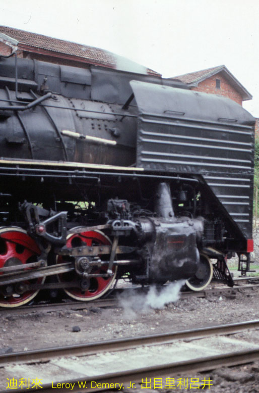
Steam locomotive QJ (前进, Qiánjìn) 1172 (Datong, 1971) at Chongqing station.I believe that this is the train I rode from Guiyang to Chongqing.
View near the front end of QJ (前进, Qiánjìn) 1172, at Chongqing station.
Cab end of QJ (前进, Qiánjìn) 1172, and crew, at Chongqing station.
The operator has perhaps opened the left side door for ventilation. As described previously, the weather was very hot and very humid.
(I have not seen a U.S. motorbus or trolleybus with a left-hand “driver’s door” like this trolleybus has.)
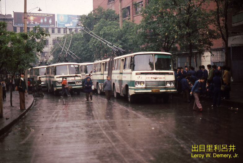
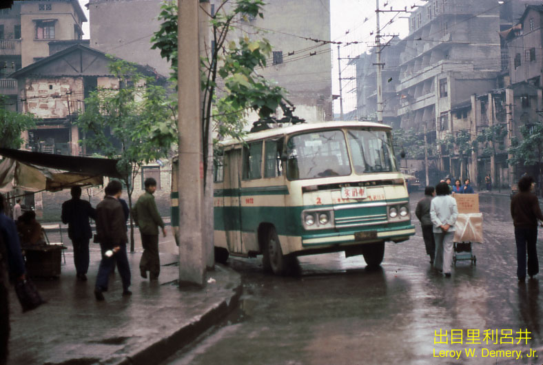
Yángjiāpíng (杨家坪) trolleybus terminal.
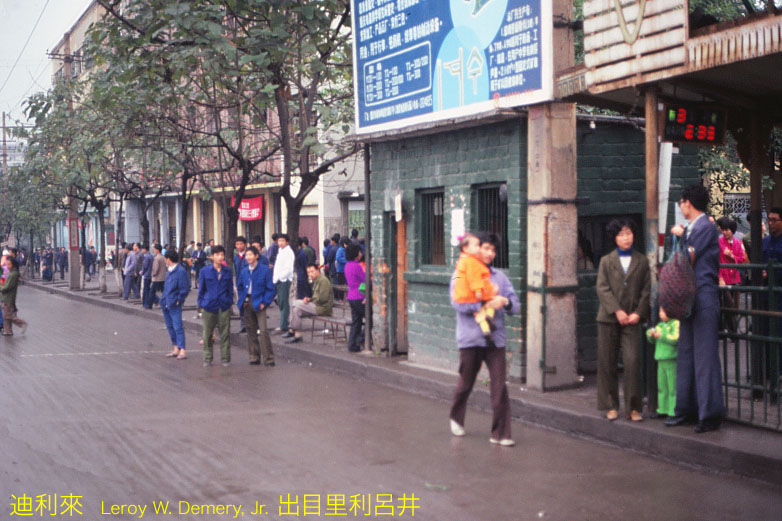
Passengers waiting at Yángjiāpíng (杨家坪) trolleybus terminal. Note the electric sign. This appears to show line number, and waiting time for the “next bus.”
This image appears to be near the southwestern terminal of trolleybus Line 103. This was named 杨家坪, Yángjiāpíng. Trolleybus line 104 also terminated here.
Street location (… if the above is correct …) was 谢家湾街, Xièjiāwān jiē, just north of 杨石路, Yāngshì lù. (That should be 谢家湾正街, Xièjiāwān zhèngjiē, and 杨石路, Yāngshi lù.)
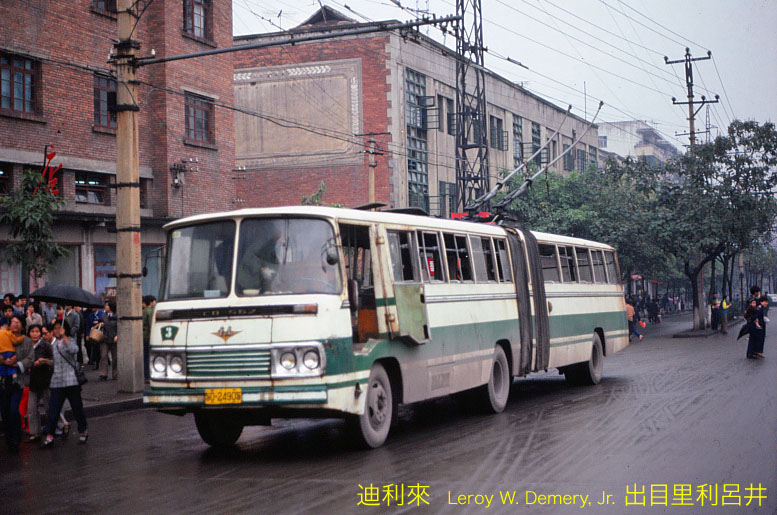
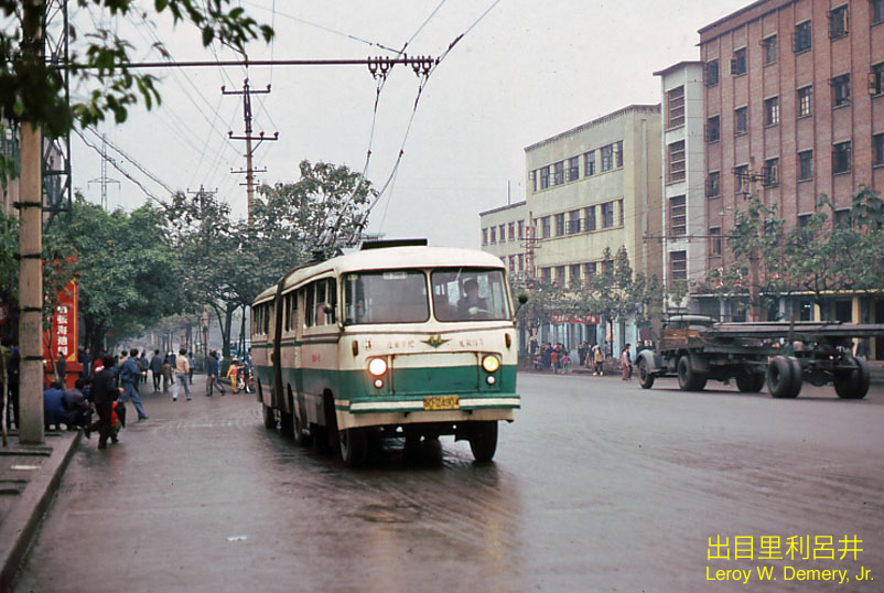
The trolleybus is a “Chongqing” built vehicle. Note the line numbers (3) painted below the windscreen (“windshield”), on the dash.
I regret that I cannot read the characters painted above the headlights.
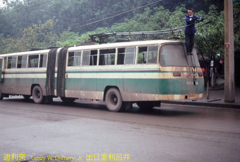
The driver appears to be adjusting the trolley poles. I believe that the location is Shāpíngbà (沙坪坝) trolleybus terminal.
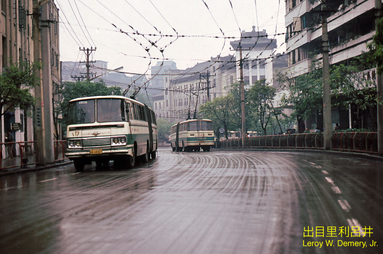
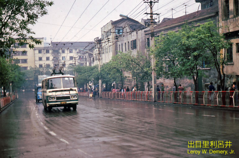
When I uploaded this image, I believed that this was a view near 朝天门, Cháotiānmén trolleybus terminal (Line 101).
However, thanks to Flickr user “micCQ,” I now know that this information is not correct (q.v., below).
This view is, in fact, near 沙坪坝, Shāpíngbà, trolleybus terminal.
The 1983 street map of Chongqing does not show this area in detail. However, I believe that the vehicle is in 小龙坎新街, Xiăolóngkăn xīnjiē. The camera is facing northwestward. In addition, I believe that the large building in the background is at 汉渝路, Hàn’yú lù
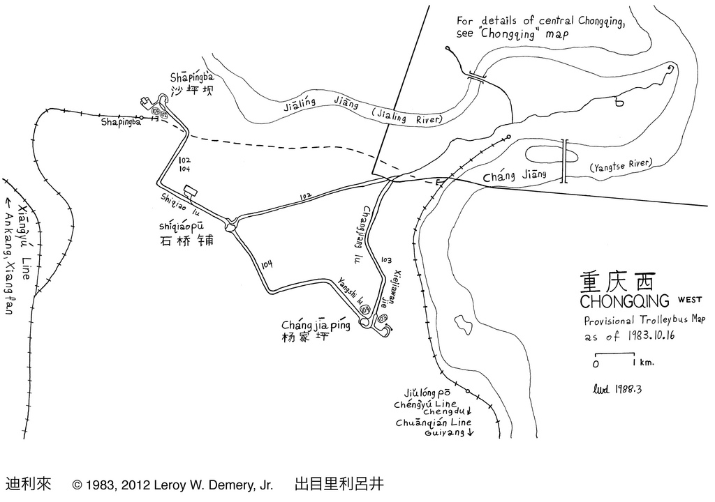
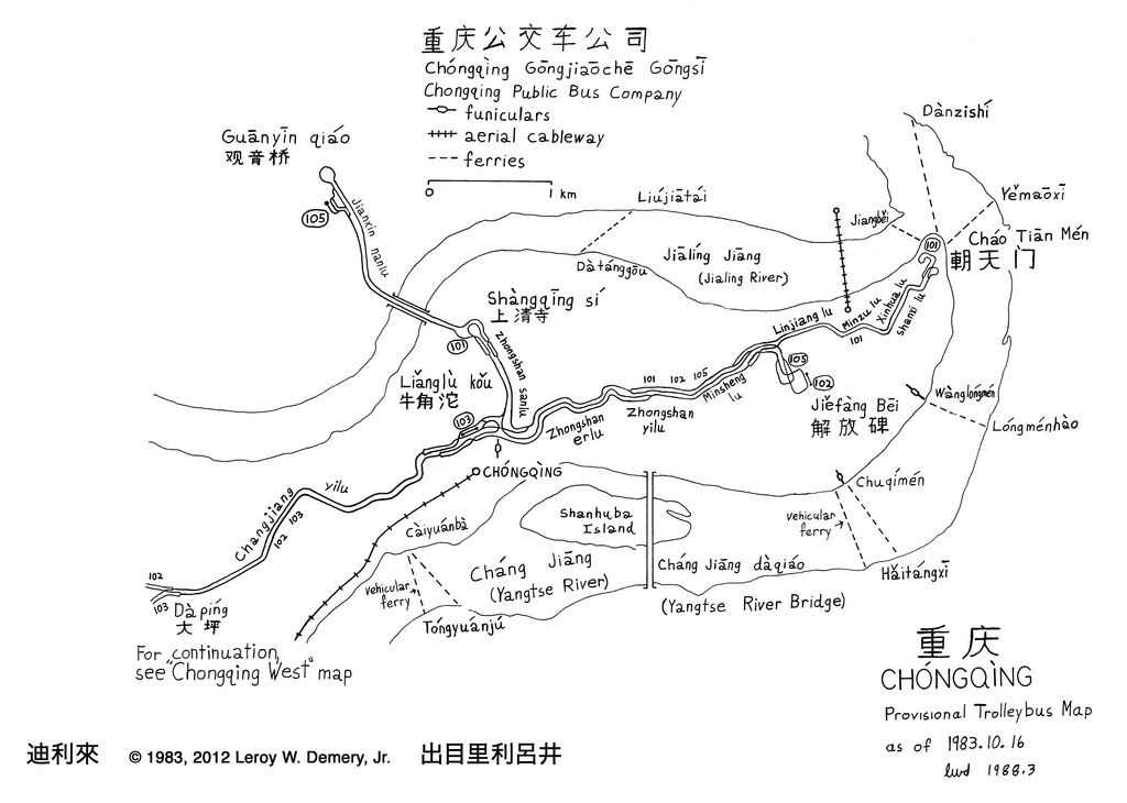
(1983 street map, and line numbers displayed on the vehicles, indicate that the trolleybus lines were numbered 1, 2, 3, 4 and 5. My notes state that the lines were numbered 101, 102, 103, 104 and 105. Perhaps I obtained this information from bus stop signs, or from a “poster” map.)
Again, I regret that I cannot read the characters painted above the headlights, on either side of the emblem (“Chongqing” brand vehicle).
However, Flickr user “micCQ” provided the following: 遵章守纪, 礼仪行车, Zūnzhāng shŏujì, Lĭyí xíngchē; “obey the traffic rules and drive the car gently (or politely).”
(We might say, “Drive courteously; follow traffic rules.”)
(Thank you, again!)
The large characters between the headlamps (“headlights”) are 教练, Jiàoliàn. This means that the vehicle is used for “instruction,” i.e. training of drivers.
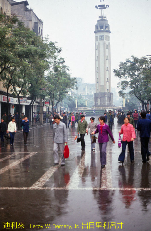
The 解放碑, Jiĕfàng Bēi, “Liberation Monument,” was once the tallest structure in Chongqing. The monument still stands, of course, but the surrounding “cityscape” has been transformed:
I believe that this view is at 解放碑, Jiĕfàng Bēi, terminal of trolleybus Line 102. Line 105 terminated nearby.
Although people do not appear dressed for warm weather, I remember that the weather was warm, very humid and unpleasant.
I believe that this vehicle is turning into 中华路, Zhōnghuá lù.
Waiting passengers at 朝天门, Cháotiānmén, trolleybus terminal.
This is the terminal of motorbus Line 13. The terminal name (according to the 1983 transport map) was 小什字, Xiăoshénzì. The location is “near” 民族路, Mínzú lù. I believe that the camera was facing northeastward.
I believe that this image is in 临江路, Línjiāng lù, west of 中华路, Zhōnghuá lù.
The trolleybus is working westward. The camera is facing east.
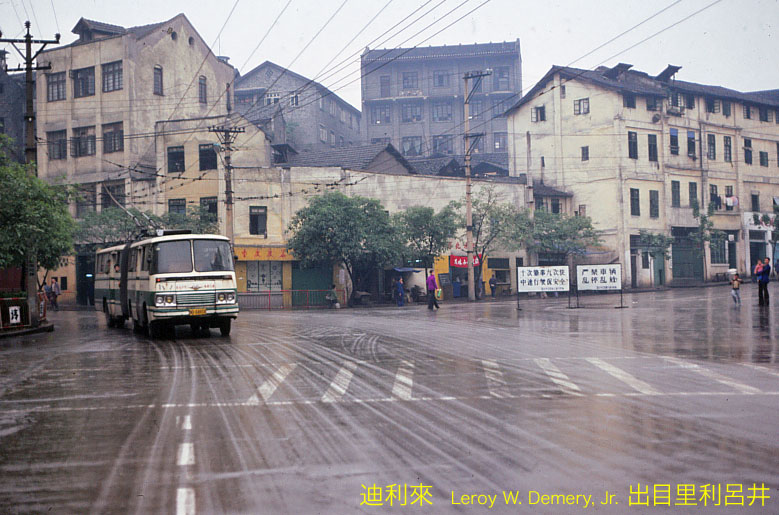
I believe that this image is in 临江路, Línjiāng lù, east of the junction with 民生路, Mínshēng lù.
The trolleybus is working eastward (on Line 1). The camera is facing west.
I believe that this image is in 民生路, Mínshēng lù (left), at the junction with 临江路, Línjiāng lù (right).
The trolleybus is working westward (on Line 1). The camera is facing east.
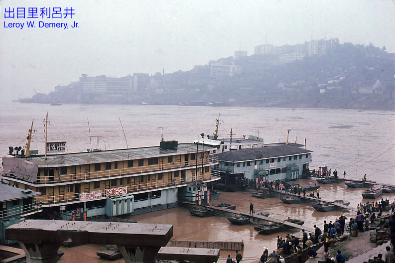
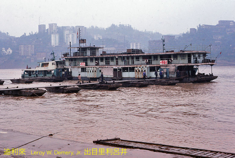
This view shows 朝天门, Cháotiānmén, river ferry terminal. Ferries (two of which are visible, behind the floating docks) crossed the Changjiang river to 野猫溪, Yĕmāoxī.
The name of the ferry service was 朝野线, Cháoyĕ xiàn, an abbreviation for “Cháotiānmén – Yĕmāoxī Line.”
A closer view of the floating dock for the 朝野线, Cháoyĕ xiàn, ferry service. The floating dock appears to be built on a barge. Note that the walkways have no handrails.
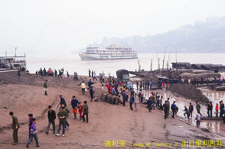
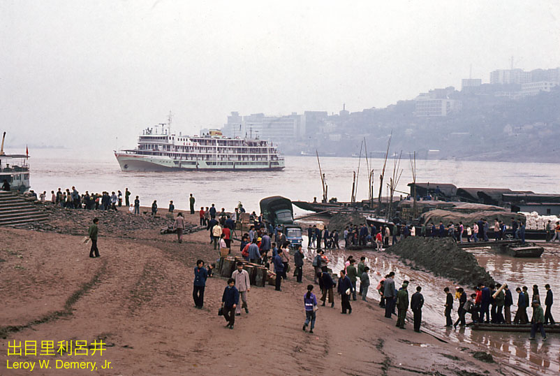
A slightly different location along the riverbank, near the passenger ship terminal. Note the passenger ship in the background.
Near 朝天门, Cháotiānmén, passenger ship terminal. The large vessel is preparing to dock.
I believe that this image shows the 望龙线, Wànglóng xiàn, ferry landing. This crossed the Changjiang river between 望龙门, Wànglóngmén, and 龙门浩, Lóngménhào.
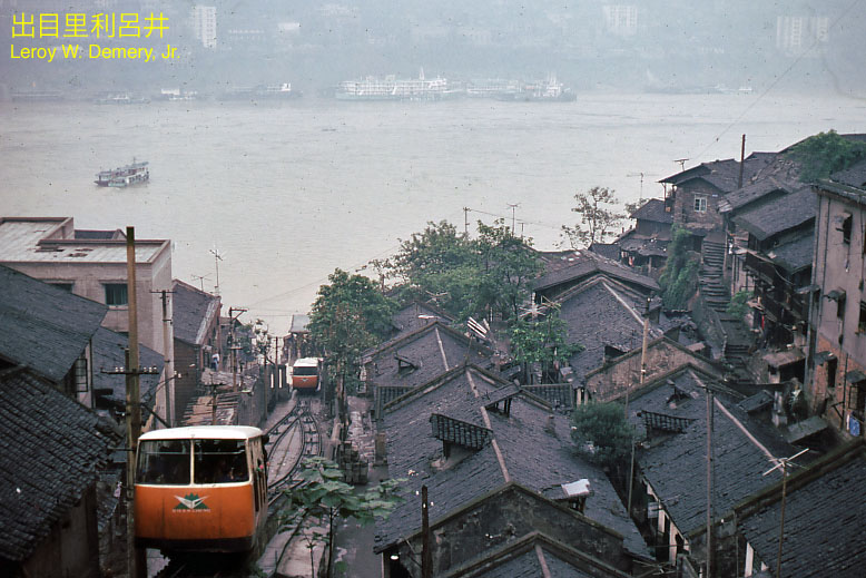
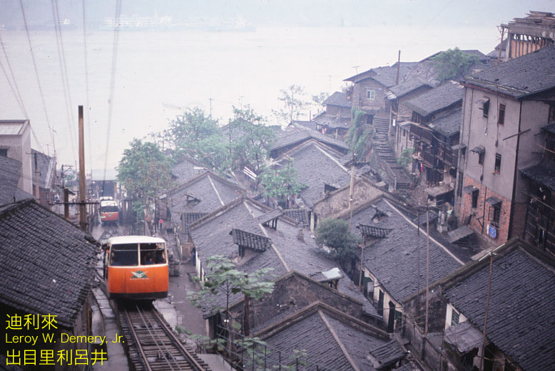
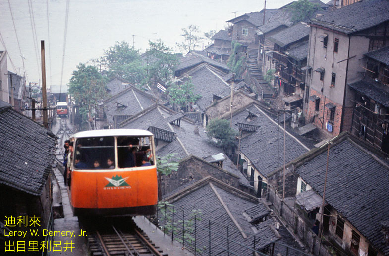
One of three urban funicular railways in Chongqing. These, according to the 1983 street map, were called 缆车, lǎnchē.
(Lǎnchē might translate into English as “Cable Car.” However, in the eastern U.S., one might say “Incline Railway,” “Inclined Plane” or just “Incline.”)
This line has been identified on the “bbs.cqbus.net” bulletin board (thank you; bbs.cqbus.net) as the 望龙门缆车, Wànglóngmén lǎnchē.
This was the easternmost of the three funicular lines then (1983) in operation.
The lettering on the dash, below the emblem, reads Shancheng. This is shown clearly in a photo on a Chinese-language website:
groups.tianya.cn/bulo/ShowArticle.asp?idWriter=0&Key=…
(山城, Shānchéng, means “mountain city.”)
This line was designed by the noted structural engineer, 茅以升, Máo Yĭshēng (1896-1989). Design work was started in 1944 July, and construction was started in 1945 April. The line was opened on 1945 May 16.
The length of the line was 178 meters. The vertical rise (Hd) was 46.9 meters.
The operator title, after 1954, was 重庆缆车公司, Chóngqìng lănchē gōngsī (roughly, “Chongqing Cable Car Company”).
My notes state that the fare (at 1983) was Y0.01 down, and Y0.02 up.
The line once carried 700,000 passengers per day. New bridges and an aerial cableway were built across the 长江, Chángjiāng (Yangtse) river, and connecting ferry services were withdrawn. Traffic fell to 13,000 per day by 1995. The line was closed in 1996.
A “Chongqing Evening News” article (in Chinese) shows a photograph of the disused trackbed and provides a brief history.
www.cqwb.com.cn/webnews/htm/2006/8/1/206939.shtml
Another view of the 望龙门缆车, Wànglóngmén funicular railway.
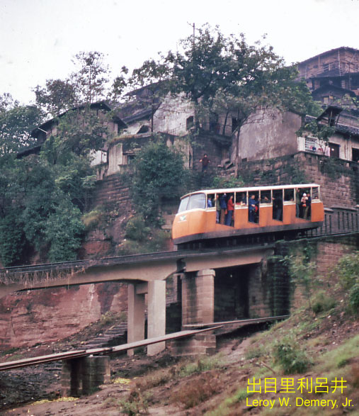
The three funicular railways of Chongqing might have been the most unusual public transport systems in China.
I believe that this view is near the base station of the 望龙门缆车, Wànglóngmén funicular railway.
(… imagine what an American or European railway safety inspector might say upon viewing this scene …)
Chinese-language sources online state that the cars seated 50 passengers … and photographs suggest that they did not have doors or doorway barriers.
The second of the three funicular railways was the 储奇门缆车, Chŭjīmén lǎnchē, very roughly 1 km upstream (west) of the Wànglóngmén line. This was closed ca. 1996.
The third of Chongqing’s three funicular railways was the 两路口缆车, Liănglùkŏu lănchē. This connected the railway station with the western portion of the Chongqing business center. It has since been closed.
Chongqing had at least four other funicular railways. With one exception, details are scarce.
临江门缆车, Línjiāngmén lǎnchē. I believe that this “might” have connected the 嘉陵江, Jīalíng jiāng (Jialing River) with the city above, north of the 解放碑, Jiĕfàng Bēi (Liberation Monument). Information online, in Chinese, states that construction was started in 1958 and stopped in 1963 because of financial reasons.
龙门浩缆车, Lóngménhào lǎnchē. I that believe this “might” have been on the right (east) bank of the 长江, Chángjiāng (Yangtse) river,
西岩关缆车, Xīyánguān lănchē. Information online states that this was opened in 1964 October. The line length was 282 meters, and the vertical rise (Hd) was 110 meters, the greatest among Chonqing’s funicular railways. Passenger traffic is stated at 30,000 per day [“3 million per day (!),” as originally posted, was my error]. However, I could find no location about where this was located.
朝天门缆车, Cháotiānmén lǎnchē. This was the most recent of Chongqing’s funicular railways. It was built by the Chángjiāng river passenger ship undertaking. Construction was started in 1983, and the line was opened on 1984 January 1, according to information online. It was built to carry passengers between the 朝天门, Cháotiānmén, district and passenger ship landings. Operation was suspended in 2007 May because of safety concerns.
Online sources describe two earlier funicular railways at Cháotiānmén, “north” and “south.” These do not appear on the 1983 street map.
1983 October 16.
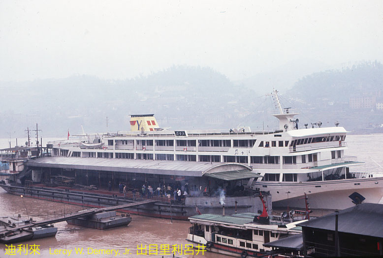
This is the Changjiang river ship that appeared in two previous images (“Chongqing – 19” and “Chongqing – 20”). It has docked at the 朝天门, Cháotiānmén passenger terminal.
The name appears on a sign to the right of the funnel, but I cannot read the “fancy” style of calligraphy.
1983 October 16.
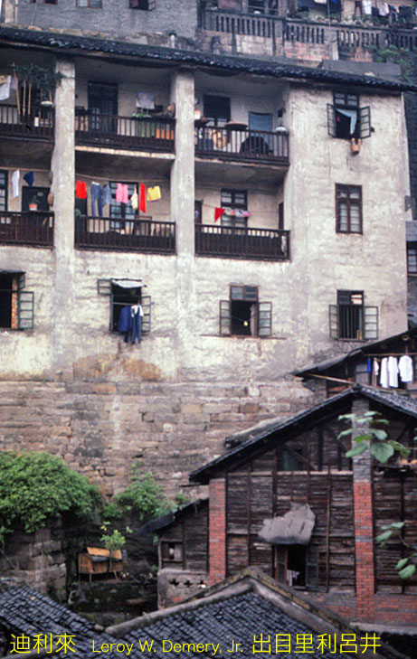
I believe that these flats were near 两路口, Liănglùkŏu, and the railway station.
Near Chongqing station (at left, out of the photograph). Note the 两路口缆车, Liănglùkŏu funicular railway, in the background.
嘞个才是我的重庆,小时候大人在屋头摆龙门阵,嫌娃儿闹,一家给五分钱坐缆车,坐到逗不下来,把脚杆伸到车厢外头晃,好耍惨了







Comments are closed.